
Mountain Goat Hiking Trail Cartographic Map by Maury Ballenger
Mountain Goat Hiking Trail Cartographic Map by Maury Ballenger
$25.00
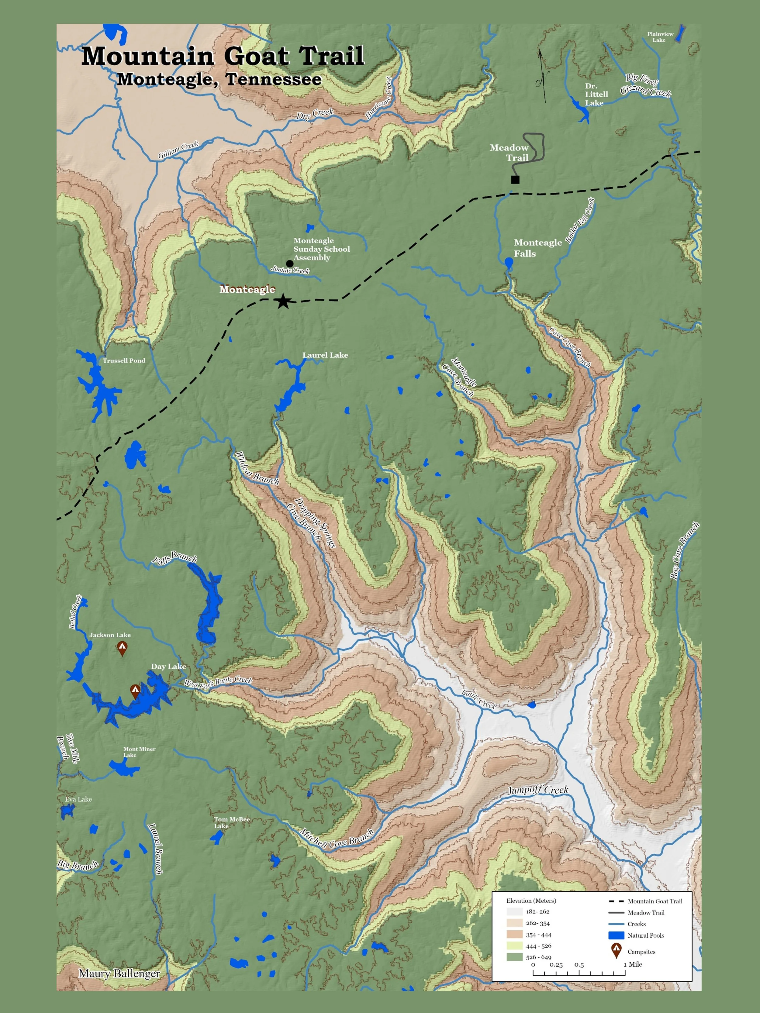
The purpose of this Geographic Information Systems (GIS) project was to create a map visualization of the Mountain Goat hiking area in Monteagle, Tennessee that follows good cartographic principles. The points, lines and polygons were hand digitized by Maury Ballenger.
For more details about this map visit my ArcGis Story Map